The ‘Mid North’, a rather ambiguous description of the region east of Spencer Gulf situated well below the geographic centre of the state, is generally accepted to encompass a rectangular area north from Kapunda to Carrieton and from Port Pirie to the pastoral country east of Burra. The area is about 140 kilometres from east to west and 210 kilometres from north to south. Annual rainfall varies from 300 millimetres in the north to 500 millimetres in the south, with up to 650 millimetres in the Clare Hills.
The terrain varies from mangrove swamps and coastal plains along the eastern coast of Spencer Gulf between Port Broughton and Port Germein to arid pastoral plains east of Burra. These plains are interrupted by the fertile hills and valleys of the northern Mount Lofty and southern Flinders Ranges, enclosed within Goyder’s Line.
Early Settlement
Prior to European settlement, Ngadjuri people occupied the area, together with Kaurna in the south and Nukunu along the eastern coast of Spencer Gulf. European recognition of the area dates back to 1838–39 with the naming of the Hutt River after William Hutt of the South Australian Association by William Hill; in 1839 Edward John Eyre named the Broughton River for the first Church of England bishop of Australia. The area through which these rivers and their tributaries flow around Clare forms the approximate geographic centre of the region.
Topography and climate determined the principal industries and settlement patterns, in conjunction with the development and exploitation of natural resources, namely copper, cereal grain and wool. Copper was discovered at Kapunda in 1842 and Burra in 1845. With the development of mines a railway line was extended from Gawler to Kapunda in 1860 and to Burra in 1870, although mining had almost ceased by 1878 due to an influx of water at Kapunda and depletion of ore at Burra.
Vast sheep and cattle runs were established in the early 1840s, extending as far north as Price Maurice’s ‘Pekina Run’. The demand for arable farming land during the 1860s resulted in major land reform legislation. Enabling prospective farmers to buy land on credit, the Waste Lands Amendment (or Strangways) Act (1869) transformed sheep runs to small wheat farms, while other runs became forest reserves for the propagation of exotic softwoods and native hardwoods. The Beetaloo waterworks, connected to the larger Bundaleer reservoir, provided water to the Port Pirie district and northern Yorke Peninsula before River Murray water became available from the 1940s.
Towns and Industries
Towns surveyed in the 1870s included Georgetown, Gladstone, Laura, Caltowie, Jamestown, Yongala, Terowie and Pekina, the most northerly township within Goyder’s Line. Schools, churches, local government, pubs and roads were established and local businesses flourished. Narrow- and broad-gauge rail networks followed as coastal outlets for bagged grain were established at Port Wakefield, Port Pirie and Port Germein. Railway sidings and towns were built at Merildin, Hamley Bridge, Gladstone, Petersburg (Peterborough), Melrose and Wilmington, to name a few. Peterborough and Gladstone are two of the few junctions in the world where narrow, standard and broad gauge rails were laid together. The Peterborough to Quorn narrow gauge railway officially closed to freight traffic in the mid-late 1980s however 'Steamtown Peterborough' operated a heritage tourist railway to Orroroo/Eurelia until 2002. Peterbough's biggest attraction these days is the Steamtown Heritage Rail Centre, a static railway museum.
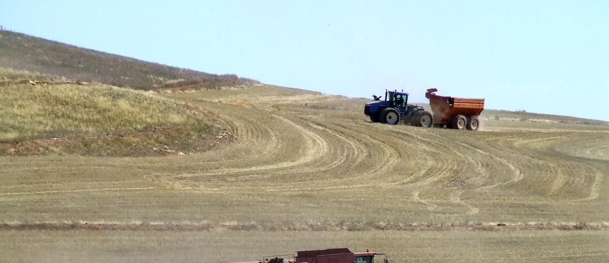
Growing wheat and grazing sheep for wool and meat remain the dominant farming activities. Others include the vineyards of the Clare Valley, where the first vines were planted in 1852 at Sevenhill by Austrian Jesuits. Vegetables are grown on the western slopes of the southern Flinders Ranges between Baroota and Warnertown, while dairying in the Laura area led to the establishment of Golden North Dairy. The principal service towns are Clare and Port Pirie. Originally an outlet for sheep, wool and wheat, the port was and remains an important export grain terminal. Port Pirie grew after the development of the Broken Hill mines in the 1880s and subsequent rail connection. From 1955 to 1962 the same railway carried uranium concentrate from Radium Hill, north east of Olary off the Barrier Highway, to be processed as yellowcake at Port Pirie. In the smelting plant built at Port Pirie by BHP (later BHAS) in 1889 to treat silver–lead–zinc ores, Pasminco Ltd now operates the largest lead smelter in the world. In 1953 Port Pirie was proclaimed South Australia’s first provincial city.
Decline
As the Mid North has developed and prospered in accordance with the opportunities and restraints of transport and technology, so too it has declined. The adoption of bulk handling of grain from the 1950s introduced vast changes on and off the farm. Concrete silos now dominate larger grain centres – Gladstone has the largest inland grain storage facility in South Australia with a capacity of 82,500 tonnes. This town was also the site for a large stone gaol, built in 1879 and closed in 1975.
Since the 1980s farm consolidation, a decline in the rural economy, and amalgamation of local councils have resulted in the waning of many smaller Mid North communities.

I'm afraid I haven't been able to find anything on that one Graham, have you already been in touch with the Hallet Historical Society? http://explorehistory.com.au/organisation/hallett-historical-society
i am trying to find the history of the wildongaleechie (wild dog ) pub at Hallett s.a.

As Catherine said, the article was published before Steamtown stopped running trains. I

Thanks for your feedback Dave. The article was first published in the Wakefield Companion to South Australian History, we've contacted authors from this publication and some have made updates, but we can't rewrite too much without the authors' permissions. We're working on further articles and updates wherever we can. You can add your own contributions by clicking on the 'add to' button next to the article title, which will then show up linked under 'your stories'.
This article is clearly dated as this section is inaccurate "Steam Preservation Society still operates a narrow-gauge tourist train to Eurelia". The Steamtown Heritage Rail Museum is now the main attraction in Peterborough.
Fraser, John Foster, Australia: The making of a nation (London: Cassell, 1912)
Griffin, T and M McCaskill, Atlas of South Australia (South Australia: South Australian Government Printing Division, 1986)
Howchin, Walter, The geography of South Australia: Historical, physical, political & commercial (Christchurch: Whitcombe and Tombs, 1909)
Meinig, DW, On the margins of the good earth: The South Australian wheat frontier, 1869-1884 (Adelaide: South Australian Government Printer, 1988)
Robinson, Nancy, Change on change: A history of the northern highlands of South Australia (Leabrook: Investigator Press, 1971)


Add your comment