Jump to navigation
SA History Bank
Search form
Search
Topics
People
Places
Organisations
Things
Subjects
Events
Discover
Stories
Collections
Tours
Resources
Maps & Plans
Bibliographies
lands_fig_-_1.jpg
You are here
Home
›
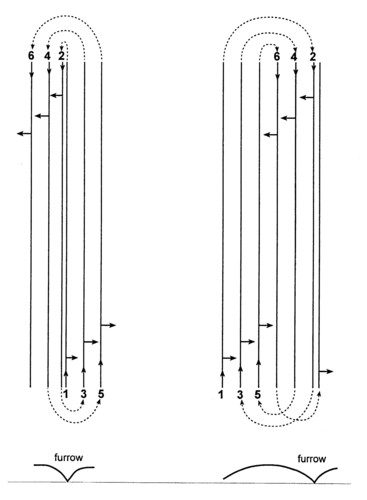
Simplified plan diagram showing how ‘lands’ were ploughed leaving a deep furrow.
Citation:
Image courtesy of CR Twidale. Not to be reproduced without permission